- About Us
- Investor Relations
- ESG
- Product & Service
- Customer Service
Customer Service
- Visiting Taiwan
TWM published TNFD Report in 2024, to address biodiversity risk assessment, Taiwan Mobile uses LEAP and follows the steps to analyze and evaluate the biodiversity and nature-related risks of the self-own operations, upstream supply chain and downstream customers. By integrating natural risk management into the Enterprise Risk Management (ERM) system, TWM ensures that all natural risks are effectively controlled through multidisciplinary, company-wide processes to prevent business interruptions and protect the interests of its stakeholders.
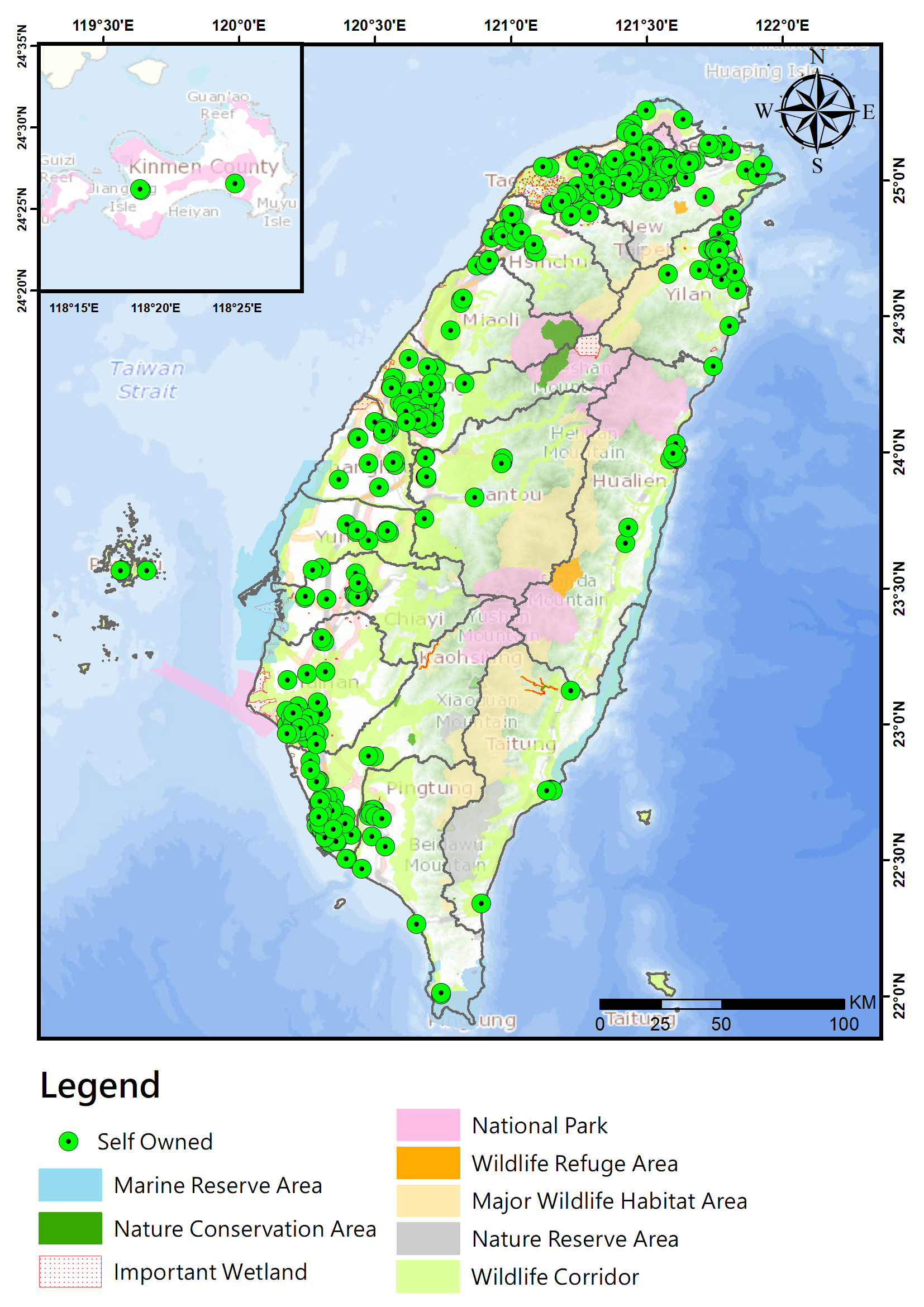
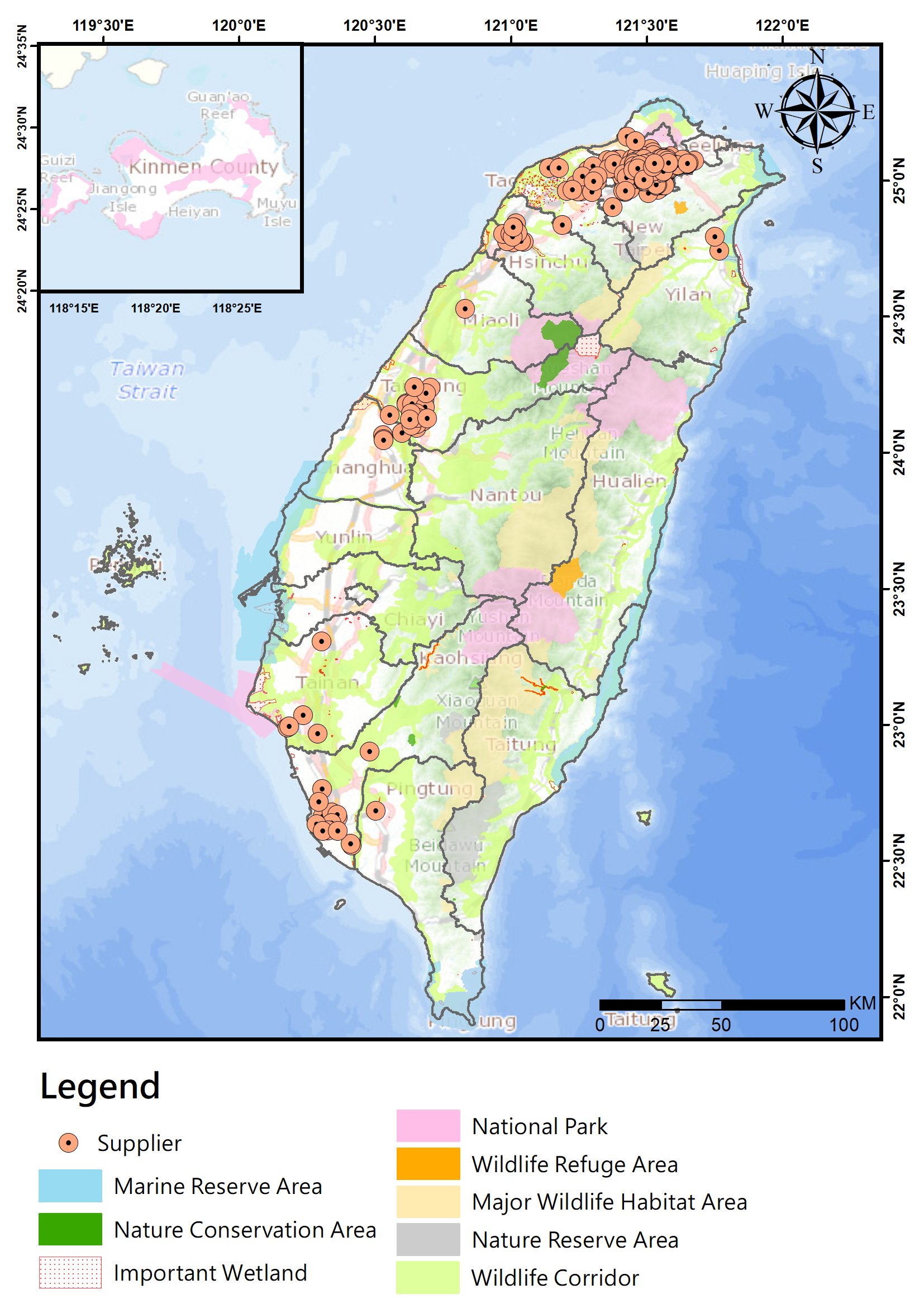
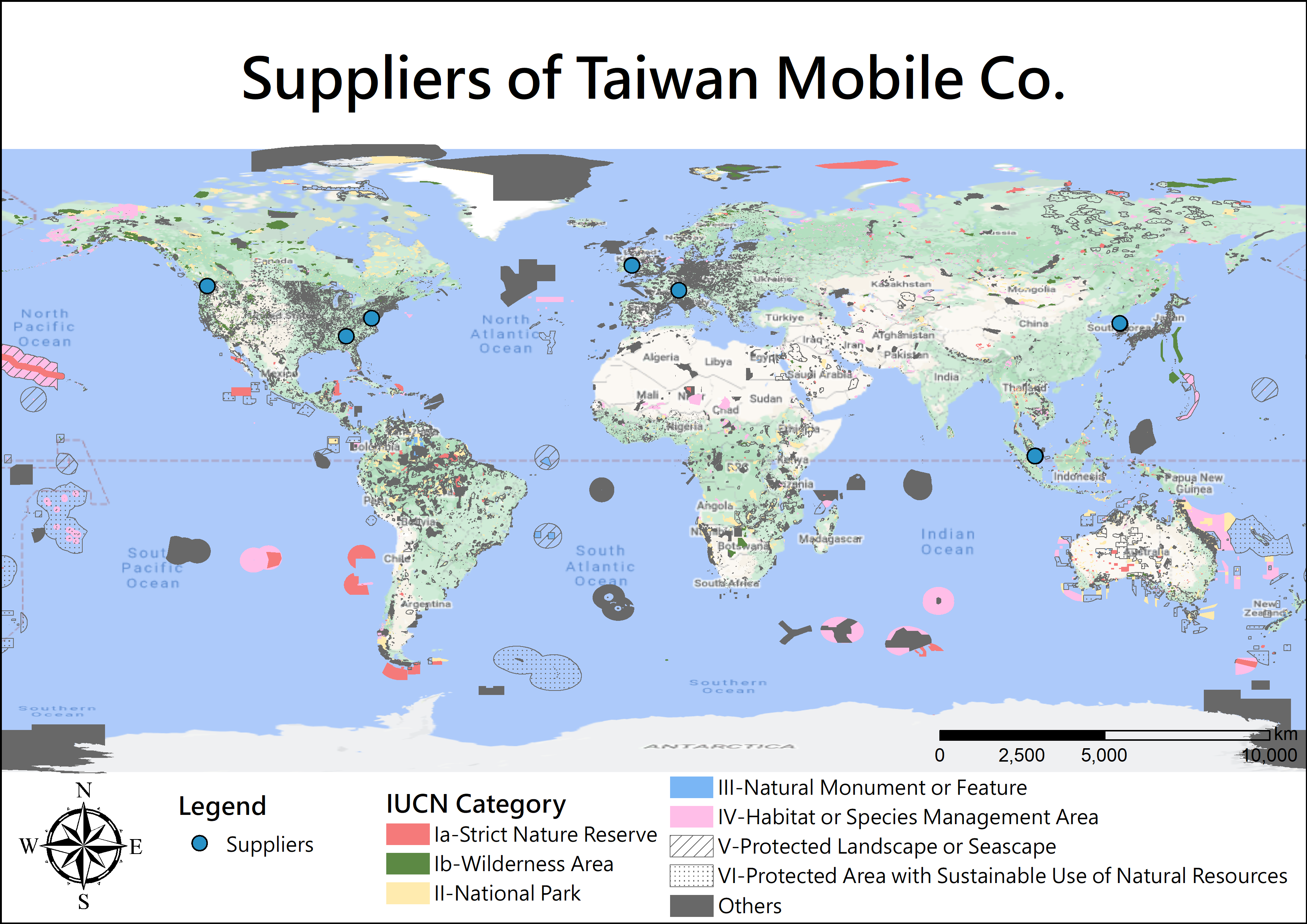
TWM uses GIS spatial data overlap analysis technology to analyze the location of direct assets and operations(site location and the adjacent areas within 2 kilometers), as well as our related value chain (upstream and downstream) activities, whether these activities overlap with specific biological or ecological protection areas. We try to understand the significance of the biological or ecosystem importance of each of these protected areas, and if we and the value chain activities have a direct relationship with them.
For Locate analysis, operation site with overlapping will be identified as priority locations. As far as the company wide as a whole is concerned, regardless of whether it is in a priority location, it will always analyze the dependence and impact. The purpose is to identify the level of dependence and impact of own operations and value chain activities on environmental- and/or bio- resources and ecosystem services.
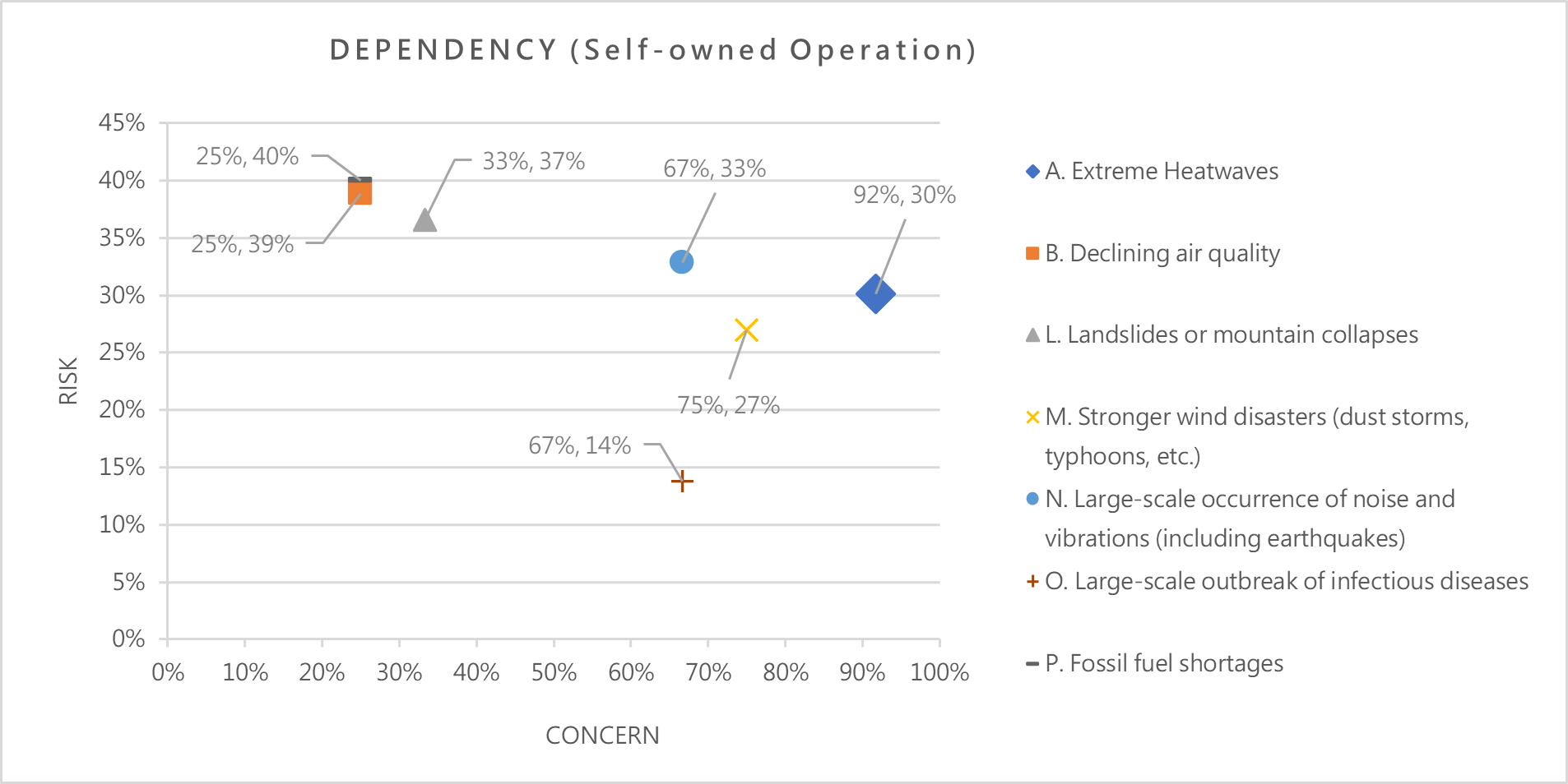
Through questionnaire survey and Encore database, TWM incorporates its own management measures and set relevant targets to evaluate residual risks. We have initially grasped the dependency of our own operations and the upstream and downstream activities of the value chain on biodiversity and natural resources, and also identified the impact of disturbance or pollution on the natural environment. For issues with relatively high levels of residual risk, we will also gradually implement mitigation actions.
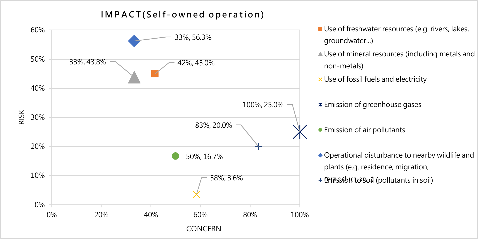
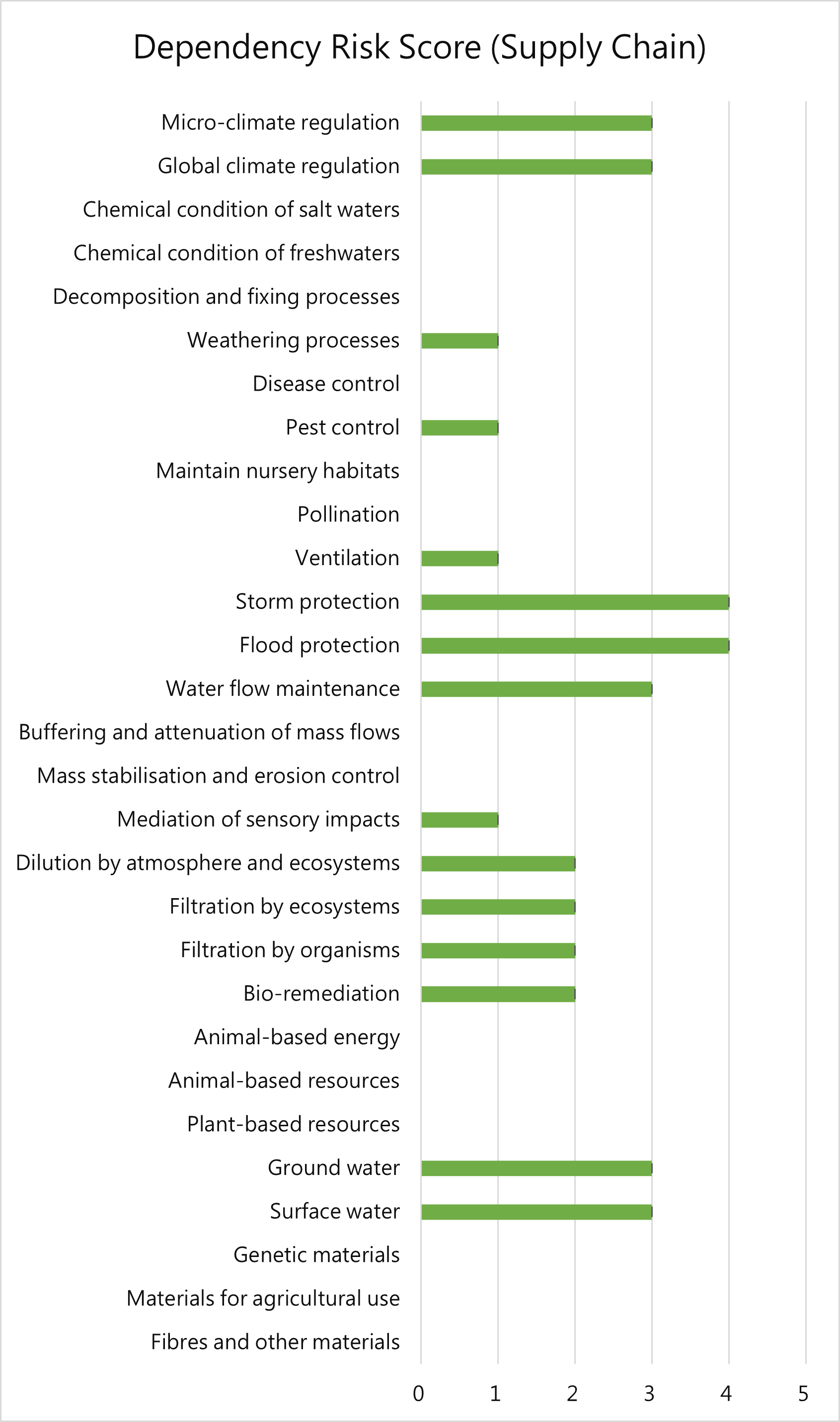


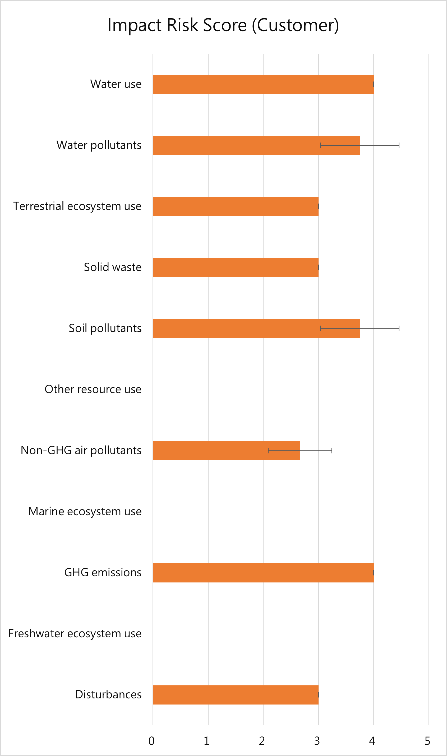
The results of the analysis have been disclosed on the public webpage as shown here. On the internal and long-term management of TWM, we will discuss what strategies and resource allocation decisions should be made, set targets, define and measure progress in the near future.
TWM directly obtains the publicly available GIS layers of the local government, and its information includes biologically sensitive areas, reserves or protected areas protected or restricted by laws and regulations, all of which belong to the region-specific database.
Plus, TWM uses V0.4 published by TNFD in March 2023 for risk assessment and is expected to continue to adopt this framework after the final version is released in this September.
